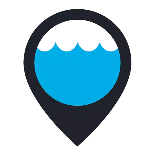
天氣 1.4.5 24.9 MB by Garden of Dreams Games ✪ 4.1
Android 6.0+Apr 30,2026
 下載
下載
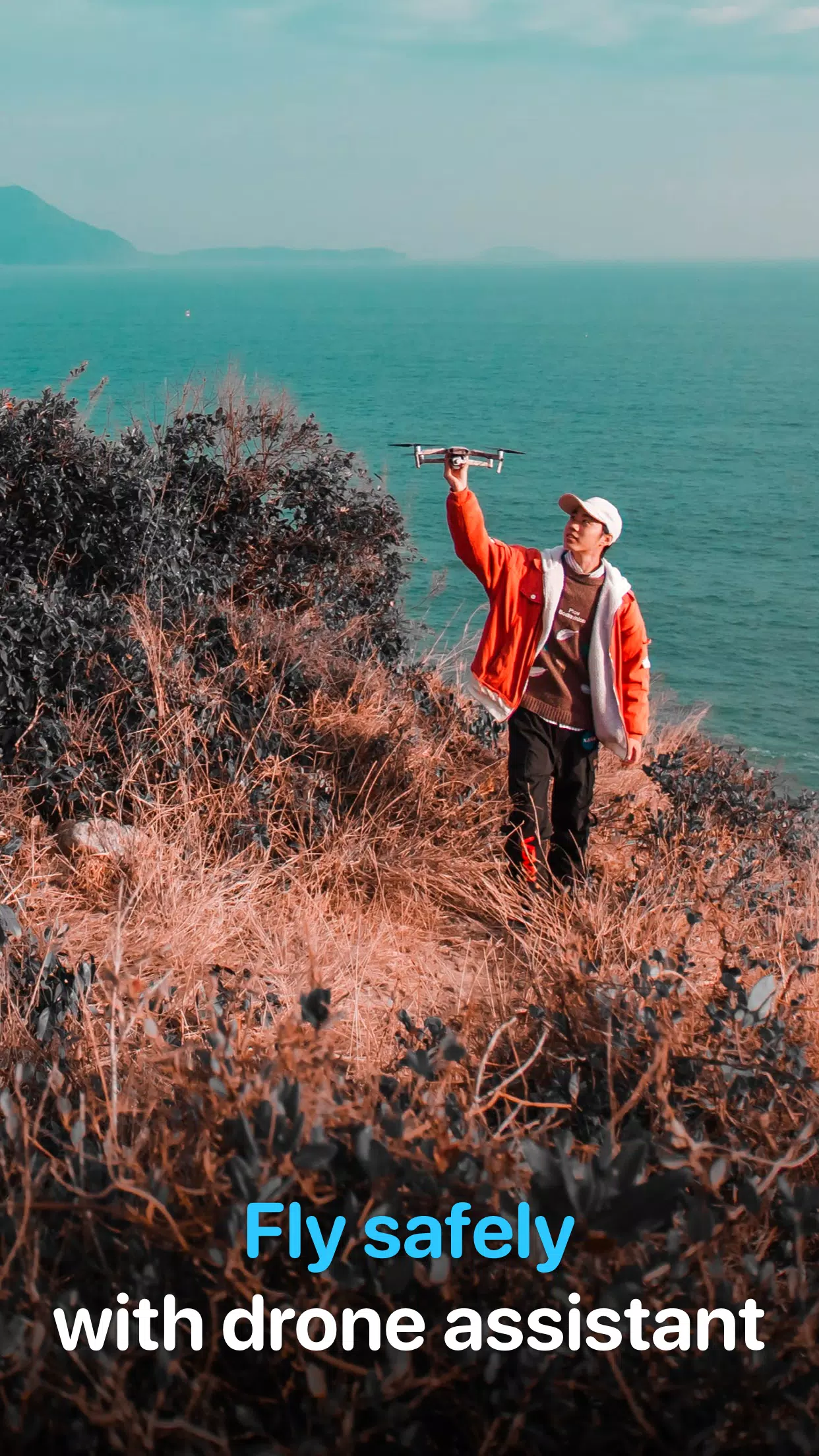
Fly safely in any conditions. Check the air map for DJI pilots and plan your quadcopter flights with our app.
在任何條件下都能安全飛行。使用我們的應用程式查看空域圖,為你的四軸飞行器規劃飛行路線。
The essential mobile app for UAV and DJI pilots. Get ready to fly.
無人機與大疆飛行員必備的行動應用程式。準備好起飛吧!
Drone Forecast is the trusted companion for both hobbyists and professional pilots. Fly your drone more safely. Check weather conditions before takeoff and stay informed about no-fly zones using our air map.
Drone Forecast 是業餘愛好者與專業飛行員信賴的夥伴。讓你的無人機飛得更安全。起飛前查看天氣狀況,並透過我們的空域圖隨時掌握禁航區資訊。
Ensure safe flights for your UAV, RC Aircraft, or DJI drones!
確保你的無人機、遙控飛機或大疆飛行器的安全飛行!
All essential flight information in one mobile app:
所有必要的飛行資訊,一應俱全於行動應用程式中:
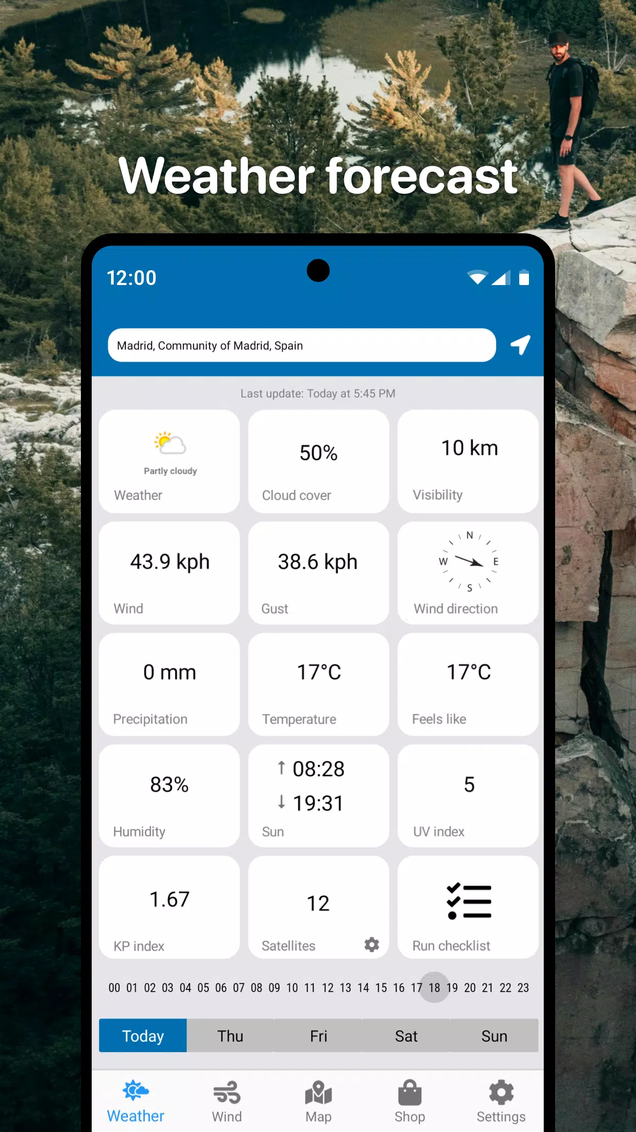
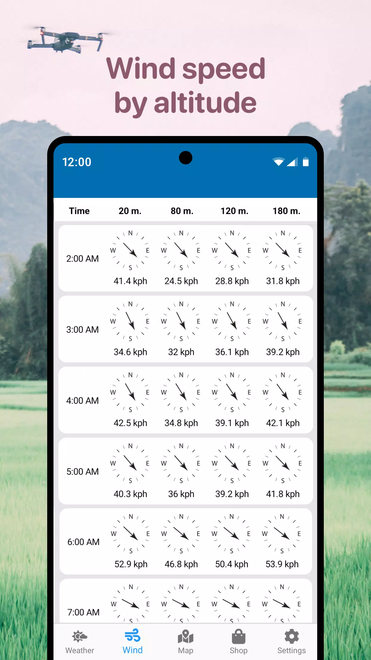
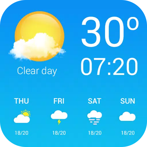
- Detailed real-time weather forecasts for UAVs in your selected area
- 你選擇區域內針對無人機的詳細即時天氣預報
- Hourly forecasts and 3-day outlook
- 每小時預報與三天展望
- Wind speed, peak gusts, direction, and detailed altitude data
- 風速、陣風極值、方向以及詳細的高度數據
- Sunrise and sunset times
- 日出與日落時間
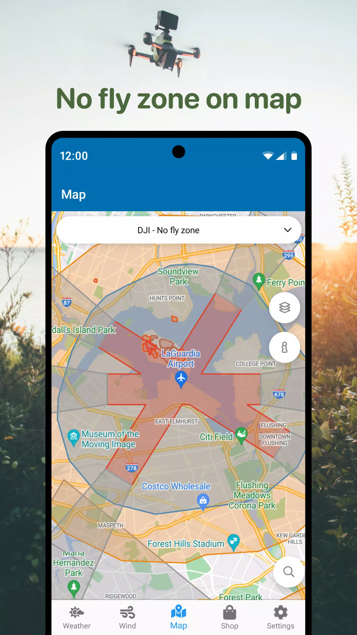
- No Fly Zone air maps for drones
- 無人機禁航區空域圖
- Compass to determine wind direction
- 用於判斷風向的指南針
- Additional useful parameters for DJI and other drones
- 大疆及其他無人機的額外實用參數
Locate safe airspace for your quadcopter flights using the No Fly Zone map. Steer clear of airports, heliports, and other restricted areas marked in red.
利用禁航區地圖尋找適合四軸飞行器飛行的空域。避開機場、直升機坪以及其他標示為紅色的限制區域。
This drone mobile app is your ideal assistant for safe drone deployment, helping you avoid poor weather and restricted zones. Quickly access vital information for flight planning, including UAV wind forecasts and no-fly zone maps.
這款無人機行動應用程式是你安全部署無人機的理想助手,幫助你避開惡劣天氣與限制區域。快速獲取飛行規劃所需的重要資訊,包括無人機風力預報及禁航區地圖。
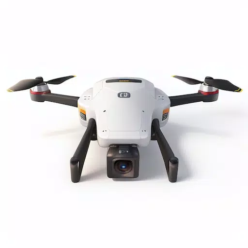
A universal tool with air maps for various drones: DJI Mavic, DJI Phantom, Inspire, DJI Mini, DJI Air, Spark, Parrot Bebop, Xiaomi, Autel, Walkera, Yuneec, Hubsan, FIMI, Syma, Volocopter, Skydio, and other Unmanned Aerial Vehicles (UAV).
一款適用於各種無人機的通用工具,提供空域圖:大疆 Mavic、Phantom、Inspire、Mini、Air、Spark;Parrot Bebop;小米;Autel;Walkera;Yuneec;Hubsan;FIMI;Syma;Volocopter;Skydio 以及其他無人飛行器(UAV)。
Download the mobile drone app now and pilot your RC Aircraft, UAV, and DJI drones with confidence and safety.
現在下載行動無人機應用程式,自信且安全地操控你的遙控飛機、無人機及大疆飛行器。
### What's New in the Latest Version 1.4.5
### 最新版本 1.4.5 更新內容
Last updated on Oct 22, 2024
最後更新日期:2024 年 10 月 22 日
- Performance improvements
- 效能提升
 類別
類別 


發現最好的美容應用程序,以增強您的化妝和護膚程序!這個精選的系列具有最高評價的應用程序,例如魔術美容化妝相機,美容和公主攝像頭,化妝創意,Foreo(用於護膚設備),簡單的髮型逐步逐步,Fooketone,Snapart,Snapart,化妝照片編輯器,美容化妝照片編輯器和化妝相機:自拍編輯器和美容妝容。改變您的自拍照,找到化妝靈感,並探索創新的護膚工具。找到完美的應用程序,以實現您所需的外觀並立即提升您的美容遊戲!
FaceTone
Makeup Camera: Selfie Editor & Beauty Makeup
Beauty Plus公主相機
SnapArt Pro Ai Photo Editor
Makeup Ideas
FOREO For You
臉部化妝相機和照片編輯器-相機